Archaeological Field Work | 2014 Season - Excavations at Skiphóll Mound in Leiruvogur and the Low-Highland Site of Borg
The 2014 MAP fieldwork largely continued in the pattern set forth in the year previous. The low highland site at Borg saw continued excavations as did the inner Skiphóll mound near Leiruvogur harbor. Geophysics surveys continued in the larger Mosfell landscape. The accumulation of much information from the past years resulted in a substantial dedication to the processing of post-excavation materials, hinged around environmental data such as pollen cores as well as material culture finds.
The excavations at Borg specifically targeted an uneroded mound that was confirmed in 2013 to contain turf walls, potentially from the Landnám period. A structure was confirmed to have been present inside the mound, confirming a Viking Age occupation and use of the area, although perhaps short-lived.
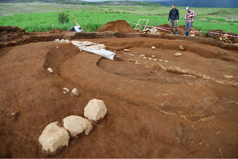
The excavations at the inner Skiphóll mound were a continuation of the Leiruvogur Harbor Research Project and the next step after the initial fieldwork there in 2013. The goal was to identify cultural and archaeological features, considered in the larger context of North Atlantic trade and contact. The harbor is mentioned in medieval Icelandic sources in particular. In 2013 clear signs of anthropogenic activity at the inner, eastern mound were identified. GPR results indicate multiple phases in the mounds’ usage. A 2014 trench indicates a mid to late 9th century creation for the mound, potentially seen as a burial mound, and perhaps most significantly, there is evidence of a circular ditch around it. Furthermore, it is possible that in an earlier phase of the mounds’ usage, the ditches were cut to meet in a point in the overall resemblance of a ship.
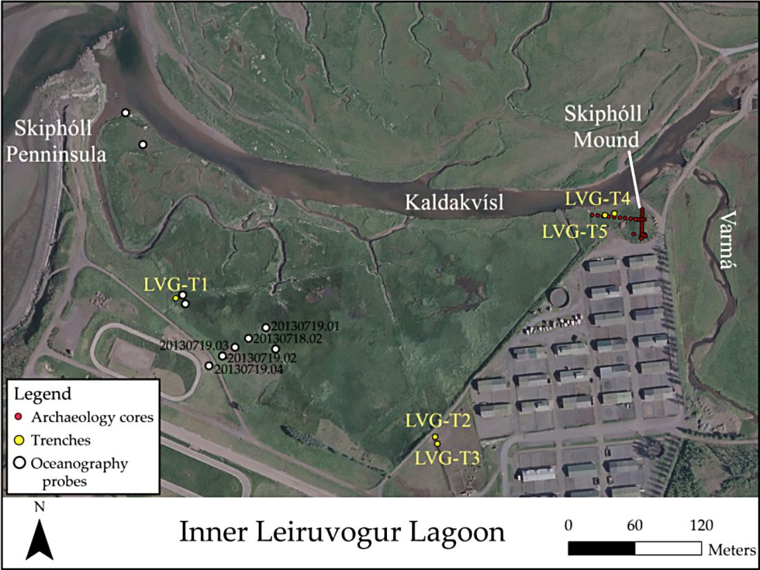
Post-excavation analysis revealed new information. Pollen from Hrísbrú indicates that the farm was established very early in relationship to the Landnám tephra, potentially before it. Accelerator Mass Spectrometry on charred barley, charcoal, textile, and human bone samples established refined dates for specific contexts in Mosfell Valley. GPR was used in Leiruvogur Harbor, at Borg, around Hrísbrú, and in the area of Blikastaðir, giving indications in specific places of the presence or absence of anthropogenic activity, amongst other things.
